AERIAL PHOTO • VIDEO • DOCUMENTATION

See the whole property.Show the real progress.

Professional aerial visuals for real estate, construction, commercial properties, roofs, events, and local businesses.

Fort Mill • Rock Hill • Tega Cay • York County • Charlotte

Aerial front view of a residential property photographed by Devon's Droneography
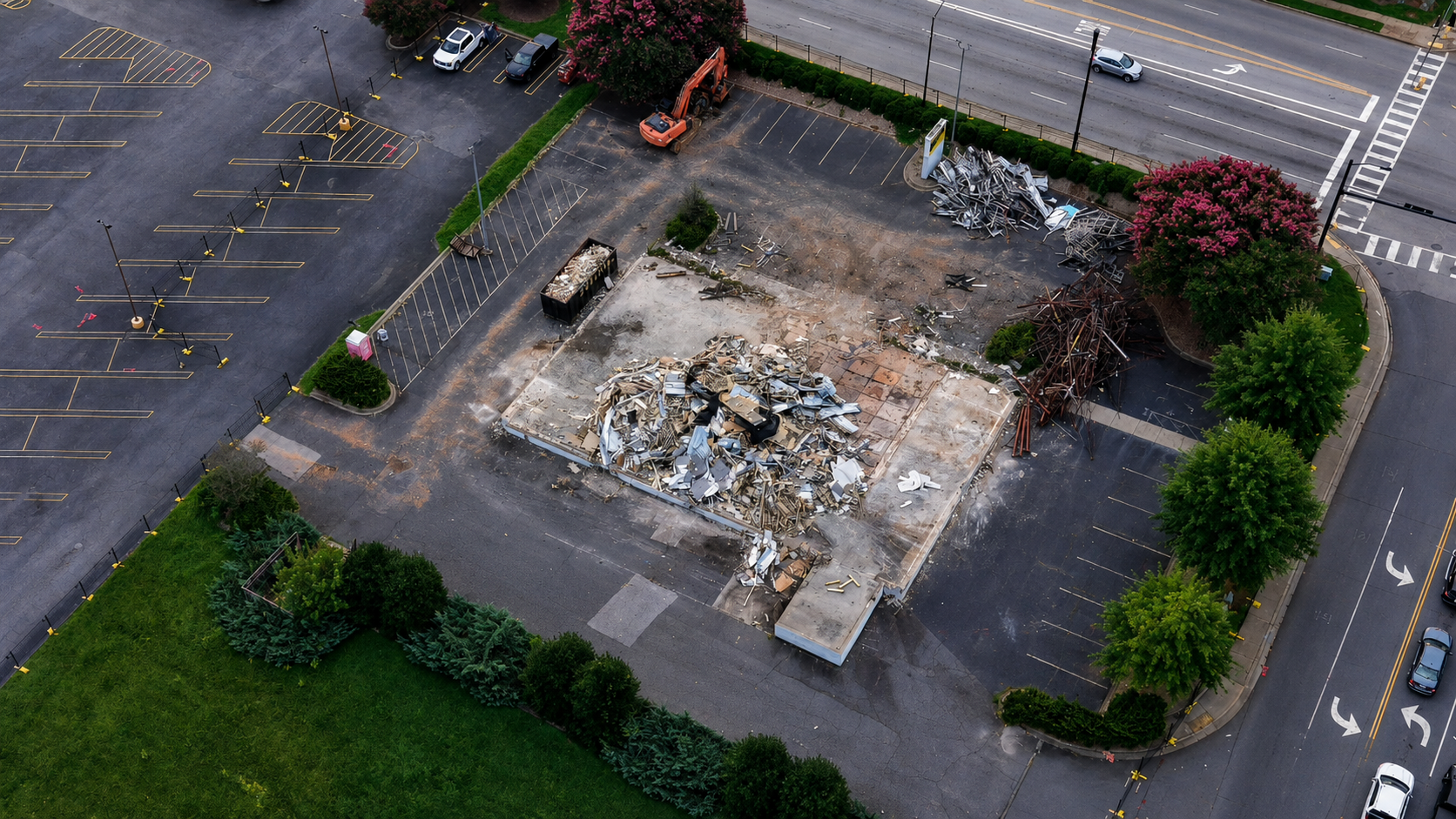
Aerial demolition progress view photographed by Devon's Droneography
Construction + demolition documentation
FAA Part 107 CertifiedCommercial Remote Pilot
Fully InsuredProfessional operations
24–48 Hour DeliveryFor most standard projects
Local ServiceServing the Charlotte metro

SERVICES + STARTING PRICES

Professional aerial services, clearly priced.

Every project is planned around the property, airspace, weather, and final deliverables. Custom scopes receive a clear quote before booking.

01

STARTING AT

Real Estate Aerial Photos

Professional exterior angles, overhead views, property context, and listing-ready edits.

$125 per project
02

STARTING AT

Real Estate Photo + Video

A complete aerial package built for listings, social media, and property marketing.

$225 per project
03

STARTING AT

Roof & Property Documentation

Clear aerial visuals of roofs, exteriors, hard-to-reach areas, and property conditions.

$150 per project
04

STARTING AT

Construction Progress Updates

Repeatable overview, top-down, site-context, and demolition progress documentation.

$179 per project
05

STARTING AT

Event Coverage

Aerial photo and video coverage for community gatherings, outdoor events, and venues.

$200 per project
06

CUSTOM

Commercial & Custom Projects

Commercial properties, local-business content, social media visuals, and custom aerial work.

Quote

RECENT WORK

Real properties. Real project documentation.

Explore the portfolio

PORTFOLIO

Every frame earns its place.

The images below are Devon's actual aerial work—presented in consistent, uncropped frames so the full property and project context stays visible.

01 / Residential real estate

Listing coverage • Property context • Key features

02 / Construction + demolition

Overview angles • Progress records • Site access

HOW IT WORKS

Clear planning. Safe capture. Fast delivery.

From the first message to final delivery, you will know what is being captured, what it costs, and when to expect it.

01

Share the project

Send the property location, desired deliverables, preferred date, and how you plan to use the visuals.

02

Flight planning + capture

Airspace, weather, access, and site conditions are reviewed before a safe, efficient flight is completed.

03

Edit + deliver

Final photos and video are professionally edited and delivered digitally—typically within 24–48 hours for standard projects.

Devon Ealy, owner and remote pilot for Devon's DroneographyDevon's Droneography — Capture, Elevate, Inspire

MEET YOUR PILOT

Professional service with a local point of view.

Devon's Droneography is operated by Devon Ealy, an FAA Part 107 Certified and insured remote pilot serving businesses, property professionals, project teams, and communities throughout the Charlotte metro.

Every flight is approached with safety, reliability, clear communication, and a focus on useful visuals—not just impressive angles.

  • FAA Part 107 Certified Remote Pilot
  • Insured commercial drone operations
  • Real-estate and project-documentation experience
  • Local service with straightforward turnaround

FREQUENTLY ASKED

Before the drone takes off.

Are you certified and insured?

Yes. Devon is an FAA Part 107 Certified Remote Pilot and carries insurance for commercial drone operations.

How quickly will I receive the files?

Most standard photo projects are delivered digitally within 24–48 hours. Video, recurring documentation, and larger custom projects may require additional time confirmed in advance.

What happens if weather or airspace prevents the flight?

Safety and legal compliance come first. If weather, airspace, or site conditions prevent the planned operation, the session will be adjusted or rescheduled.

Do you handle projects outside the listed service area?

Yes, depending on the location and project scope. Send the address with your request and any applicable travel cost will be included in the quote.

READY TO PLAN YOUR FLIGHT?

Tell me about the property or project.

REQUEST A QUOTE

Let's capture what matters.

Complete the project details and your email app will open with a ready-to-send request. You can also contact Devon directly.

PHONE839-235-7559EMAILdevonsdroneography@gmail.com
SERVICE AREAFort Mill, Rock Hill, Tega Cay, York County, Charlotte & surrounding areas

This opens your email app with the request pre-filled so you can review it before sending.