01
FROM $125
Real Estate Photo + Video
Listing-ready aerial photos and video packages that show the property, lot, and surrounding context.
View details DEVON'SDRONEOGRAPHY
DRONE SERVICES • AERIAL PHOTOGRAPHY • VIDEO
Compare aerial photography, drone video, property and tower documentation, and event coverage; see exactly what one project includes; and add follow-up visits or additional media when the scope calls for more.
SERVICES AT A GLANCE
FROM $125
Listing-ready aerial photos and video packages that show the property, lot, and surrounding context.
View detailsQUOTE OPTIONS
Systematic roof and property condition reporting, storm damage records, construction progress, demolition, and commercial site documentation.
View detailsFROM $200
Aerial event coverage, community content, infrastructure views, and custom visual projects.
View detailsFROM $350
Tower overviews and equipment-detail photography for maintenance planning, project records, and before-and-after documentation.
View details
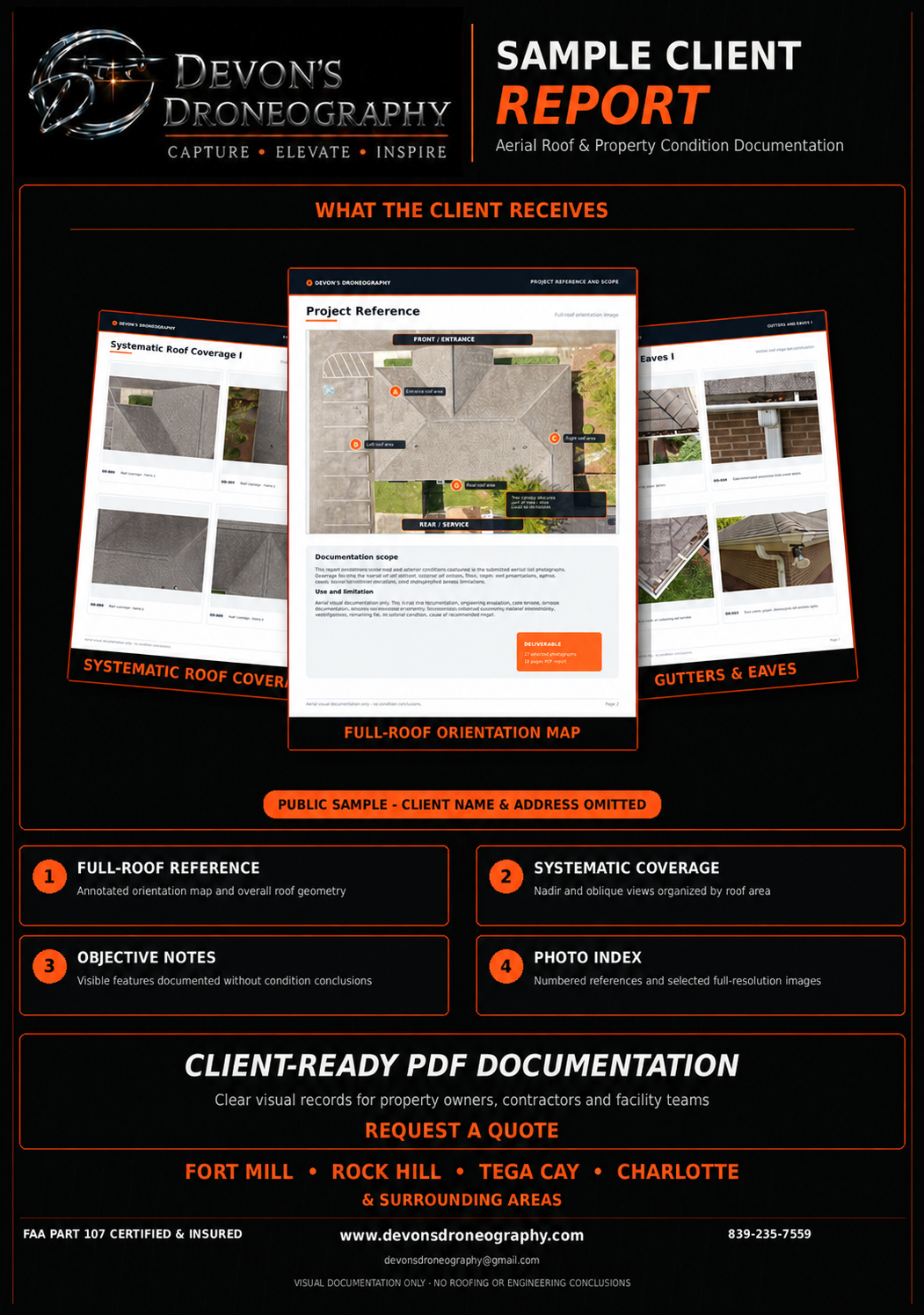 OPEN SAMPLE REPORT
AERIAL ROOF & PROPERTY CONDITION DOCUMENTATION
A structured visual record for property owners, contractors, facility teams, and other professionals who need clear documentation of observable conditions in difficult-to-reach areas.
WHAT “ONE PROJECT” MEANS
Each listed package or custom quote covers one property, job site, or event location on one scheduled date, plus the deliverables shown on that service card. Follow-up visits, extra locations, extended coverage, rush delivery, and added media are separate options.
STARTING AT
Professional exterior angles, overhead views, property context, and listing-ready edits.
STARTING AT
A complete aerial package built for listings, social media, and property marketing.
QUOTE-BASED
A systematic visual record of observable roof, exterior, and property conditions, organized into a client-ready PDF report.
STARTING AT
Clear aerial documentation of visible storm and property damage for residential properties and organized recovery records.
STARTING AT
Repeatable overview, top-down, site-context, and demolition progress documentation.
STARTING AT
Aerial photo and video coverage for community gatherings, outdoor events, and venues.
QUOTE-BASED
Commercial properties, infrastructure, local landmarks, community content, and custom aerial work.
STARTING AT
High-resolution tower photography for maintenance planning and project records, with clear views of antenna panels, mounting hardware, and cable routing.
Need labeled images? The $500 documentation package includes 25–35 photos, 5–8 labeled images, a photo index, and brief visual notes. Before-and-after and recurring visits are also available. Final pricing follows the location and agreed shot list.
OPTIONAL ADD-ONS
Add-ons are quoted separately because timing, location, airspace, and requested deliverables can change the scope. Select what you need in the quote form and Devon will confirm the full price before booking.
ADD TO YOUR QUOTE
A separate visit to the same property or job site. For construction and demolition, the approved angles can be repeated so progress is easy to compare.
CUSTOM PLAN
Three or more scheduled visits organized as one timeline with consistent angles and clearly labeled deliveries.
ADD TO YOUR QUOTE
Extra edited photos, a longer video, a vertical social-media reel, or another final edit beyond the listed package.
ADD TO YOUR QUOTE
Faster delivery, added event coverage time, extra locations, or travel outside the standard service area.
HOW IT WORKS
From the first message to final delivery, you will know what is being captured, what it costs, and when to expect it.
Send the property location, desired deliverables, preferred date, and how you plan to use the visuals.
Airspace, weather, access, and site conditions are reviewed before a safe, efficient flight is completed.
Final photos and video are professionally edited and delivered digitally—typically within 24–48 hours for standard projects.
FREQUENTLY ASKED
One project means one property, job site, or event location on one scheduled date, plus the deliverables listed for that service. A return visit is a separate project and can be requested under Add-Ons. Recurring construction or demolition visits can also be quoted together as a progress plan.
Yes. Devon is an FAA Part 107 Certified Remote Pilot and carries insurance for commercial drone operations.
Most standard photo projects are delivered digitally within 24–48 hours. Video, recurring documentation, and larger custom projects may require additional time confirmed in advance.
Coverage is planned around the property and may include a full-roof nadir overview, detailed oblique views, roof planes, intersections, penetrations, gutters, eaves, and exterior elevations. Selected images are organized into a client-ready PDF report with numbered references and objective visual notes. This service documents visible conditions only and does not provide roofing, engineering, structural, or insurance-adjustment determinations about cause, severity, safety, or repairs.
The $150 Community Storm Relief Rate is available for neighbors affected by recent storms. One project covers one storm-impacted residential property, 15–20 organized aerial images, and delivery within 24 hours when conditions safely allow. Images can document visible roof, exterior, fallen-tree, debris, and property-wide conditions from safe angles. This is visual documentation only and does not replace a structural inspection, contractor evaluation, or insurance adjustment.
Safety and legal compliance come first. If weather, airspace, or site conditions prevent the planned operation, the session will be adjusted or rescheduled.
Yes, depending on the location and project scope. Send the address with your request and any applicable travel cost will be included in the quote.
READY TO PLAN YOUR FLIGHT?